

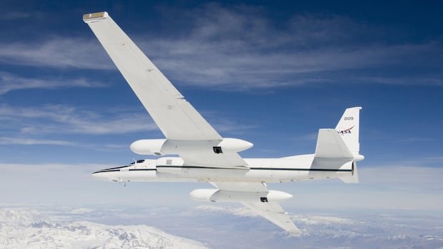

A NASA high-altitude research aircraft conducted flights over the wildfires in British Columbia over the weekend to enhance the understanding of weather phenomena caused by large fires. Flight tracking data reveals that the ER-2 plane flew multiple times back and forth over B.C.’s southern Interior on Saturday, totaling over six hours in the air, originating from Great Falls, Montana. Specifically, the aircraft spent around four hours at a 60,000 feet altitude above the Clinton area, where the extensive Pear Lake wildfire has been raging, before heading east over Lake Revelstoke and returning to U.S. airspace.
NASA’s research mission focuses on studying pyrocumulonimbus clouds, described as one of Earth’s least understood severe weather forms. These clouds, generated by extreme smoke and heat from wildfires like the Pear Lake blaze, can lead to the formation of rain, lightning, and fire tornadoes, according to the B.C. Wildfire Service. The Pear Lake wildfire, encompassing nearly 1,500 square kilometers, stands as the largest in British Columbia.
The ER-2 aircraft, a modified Cold War spy plane, renowned as the U-2, has a history of achieving extreme altitude flights, surpassing commercial flight altitudes by up to two times. Equipped with advanced infrared wildfire tracking technology, the aircraft can collect crucial data on pyrocumulonimbus clouds. NASA emphasizes the importance of monitoring these unique storms in real-time to aid in forecasting and mitigating potential risks for aviation and fire management.